File:Map of Indus Basin.png
Size of this preview: 673 × 600 pixels. Other resolution: 1,683 × 1,500 pixels.
Original file (1,683 × 1,500 pixels, file size: 180 KB, MIME type: image/png)
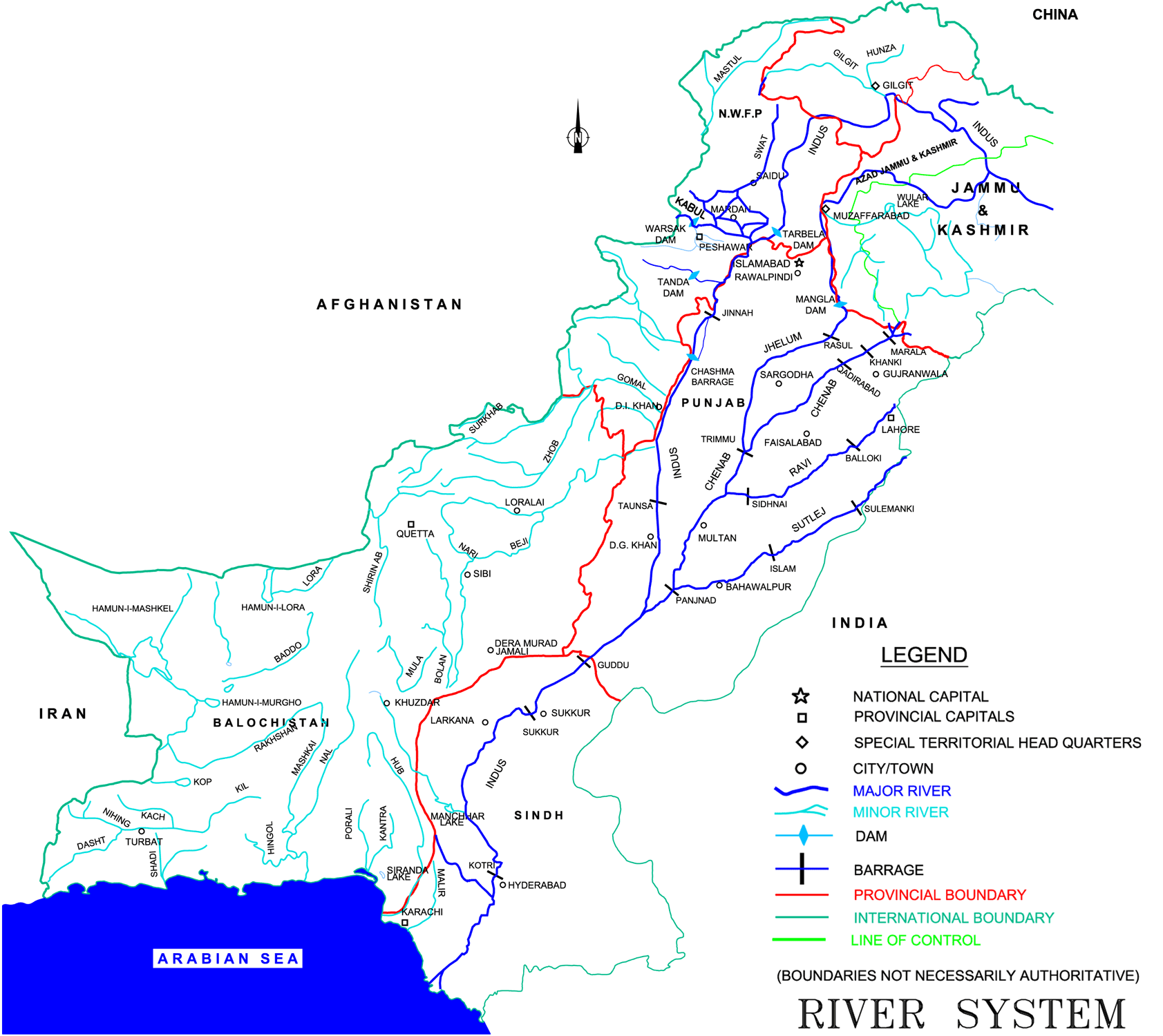
Map of Indus River System
Figure 2.2 in Ministry of Water and Power. 2002. Pakistan Water Sector Strategy Report v2, p19. Available online: http://waterinfo.net.pk/sites/default/files/knowledge/Pakistan%20Water%20Sector%20Strategy%20-%20Vol%202.pdf
File history
Click on a date/time to view the file as it appeared at that time.
| Date/Time | Thumbnail | Dimensions | User | Comment | |
|---|---|---|---|---|---|
| current | 15:46, 30 January 2015 | | 1,683 × 1,500 (180 KB) | Ashfaqm (talk | contribs) |
You cannot overwrite this file.
File usage
The following page uses this file: