File:Exhibit3-BfAf-Flooding-640x480.jpg
No higher resolution available.
Exhibit3-BfAf-Flooding-640x480.jpg (640 × 437 pixels, file size: 154 KB, MIME type: image/jpeg)
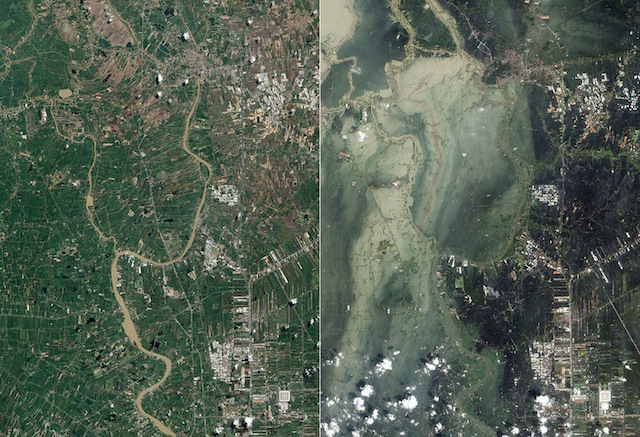
Exhibit 3: Satellite photographs showing flooding in Ayutthaya and Pathum Thani Provinces in July 2011 (left, before the flooding) and October 2011 (right, after the flooding) Source: http://en.wikipedia.org/wiki/2011_Thailand_floods
File history
Click on a date/time to view the file as it appeared at that time.
| Date/Time | Thumbnail | Dimensions | User | Comment | |
|---|---|---|---|---|---|
| current | 20:12, 12 May 2014 | | 640 × 437 (154 KB) | TSP (talk | contribs) |
You cannot overwrite this file.
File usage
The following page uses this file: