File:Great Lakes Basin Map.gif
Great_Lakes_Basin_Map.gif (400 × 298 pixels, file size: 17 KB, MIME type: image/gif)
Summary
[edit | edit source]
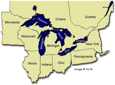
GLIN map of Great Lakes region with adjacent U.S. States and Candaian provinces, highlighting drainage basin
http://www.great-lakes.net/lakes/
Licensing
[edit | edit source]
Files listed as having license "other" do not conform to a standard public domain or creative commons standard.
This may be a file that has been included with the express permission of the creator/owner, or it may be included under the fair-use exclusion. AquaPedia will remove any files which are obviously presented in violation of their copyright, or at the request of the content owner.
Please see the file summary for more info. If you added this file, please annotate the file summary with information about the file and its terms of use and reason it was included.
File history
Click on a date/time to view the file as it appeared at that time.
| Date/Time | Thumbnail | Dimensions | User | Comment | |
|---|---|---|---|---|---|
| current | 18:04, 16 May 2014 | | 400 × 298 (17 KB) | Amanda (talk | contribs) |
You cannot overwrite this file.
File usage
The following page uses this file: