File:Hydrographic-Regions-of-Nevada.png
Size of this preview: 726 × 599 pixels. Other resolution: 1,221 × 1,008 pixels.
Original file (1,221 × 1,008 pixels, file size: 203 KB, MIME type: image/png)
Summary
[edit | edit source]
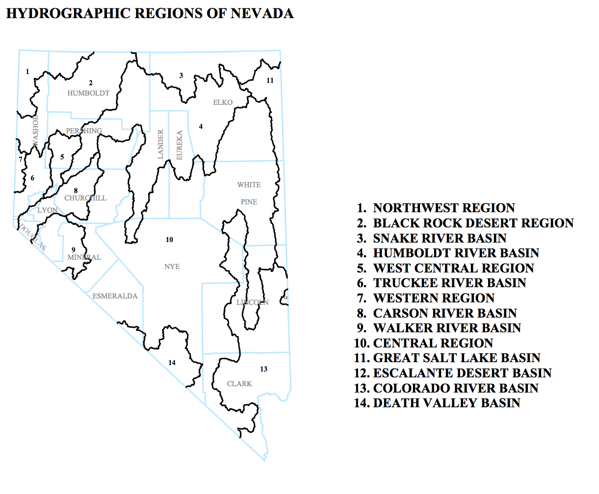
This is an inset from a map entitled "DESIGNATED GROUNDWATER BASINS OF NEVADA" produced by:
Department of Conservation and Natural Resources Office of the StateEngineer Division of Water Resources Carson City, Nevada 89701
In addition to the regions shown here, the map included/listed administrative groundwater basins.
It was accessed May 15 2013 at [1]
The map was originally produced in April 2010
Licensing
[edit | edit source]
This file is considered to be in the public domain. See the file description for any additional details.
File history
Click on a date/time to view the file as it appeared at that time.
| Date/Time | Thumbnail | Dimensions | User | Comment | |
|---|---|---|---|---|---|
| current | 20:38, 16 May 2013 | | 1,221 × 1,008 (203 KB) | Amanda (talk | contribs) |
You cannot overwrite this file.
File usage
The following page uses this file: